


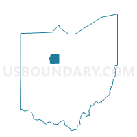
ANTRIM TWP Voting District, Wyandot County, Ohio
About
Outline

Summary
| Unique Area Identifier | 653440 |
| Name | ANTRIM TWP Voting District |
| County | Wyandot County |
| State | Ohio |
| Area (square miles) | 31.75 |
| Land Area (square miles) | 31.73 |
| Water Area (square miles) | 0.01 |
| % of Land Area | 99.96 |
| % of Water Area | 0.04 |
| Latitude of the Internal Point | 40.75413840 |
| Longtitude of the Internal Point | -83.15764480 |
Maps


Graphs
Select a template below for downloading or customizing gragh for ANTRIM TWP Voting District, Wyandot County, Ohio


Neighbors
Neighoring Voting District (by Name) Neighboring Voting District on the Map
- CRANE TWP Voting District, Wyandot County, OH
- Voting District Dallas Twp, Crawford County, OH
- EDEN TWP Voting District, Wyandot County, OH
- NEVADA VILLAGE Voting District, Wyandot County, OH
- PITT TWP Voting District, Wyandot County, OH
- PRECINCT GRAND PRAIRIE A, Marion County, OH
- PRECINCT GRAND PRAIRIE B, Marion County, OH
- PRECINCT SALT ROCK TWP, Marion County, OH
- Voting District Tod Twp, Crawford County, OH
Top 10 Neighboring County Subdivision (by Population) Neighboring County Subdivision on the Map
- Crane township, Wyandot County, OH (7,514)
- Grand Prairie township, Marion County, OH (1,590)
- Antrim township, Wyandot County, OH (1,243)
- Eden township, Wyandot County, OH (1,092)
- Pitt township, Wyandot County, OH (1,012)
- Tod township, Crawford County, OH (677)
- Salt Rock township, Marion County, OH (673)
- Dallas township, Crawford County, OH (485)
Top 10 Neighboring Place (by Population) Neighboring Place on the Map
Top 10 Neighboring Unified School District (by Population) Neighboring Unified School District on the Map
- Upper Sandusky Exempted Village School District, OH (11,713)
- Wynford Local School District, OH (6,493)
- Ridgedale Local School District, OH (4,603)
Top 10 Neighboring State Legislative District Lower Chamber (by Population) Neighboring State Legislative District Lower Chamber on the Map
Top 10 Neighboring State Legislative District Upper Chamber (by Population) Neighboring State Legislative District Upper Chamber on the Map
Top 10 Neighboring 111th Congressional District (by Population) Neighboring 111th Congressional District on the Map
Top 10 Neighboring Census Tract (by Population) Neighboring Census Tract on the Map
- Census Tract 102.01, Marion County, OH (5,231)
- Census Tract 9742, Crawford County, OH (4,345)
- Census Tract 9385, Wyandot County, OH (3,145)
Top 10 Neighboring 5-Digit ZIP Code Tabulation Area (by Population) Neighboring 5-Digit ZIP Code Tabulation Area on the Map
- 43302, OH (54,790)
- 44820, OH (18,102)
- 43351, OH (10,436)
- 44849, OH (2,260)
- 43337, OH (1,108)
- 43323, OH (680)